As a tour guide in Chicago, I spend much more time talking about Chicago as “city of neighborhoods” than a “city of community areas.” Yet the City of Chicago doesn’t officially acknowledge those neighborhoods. Instead, officially, we have Chicago community areas and aldermanic wards. These subdivisions are sociological and political, created in a think tank or lawyer’s office. They often fail to reflect the physical reality on the ground.
By contrast, the division of the city into neighborhoods feels very tangible. On some of our virtual events, we talk about how we can witness the changes in the landscape between the building types, shapes, materials and uses of different Chicago neighborhoods. You know distinctly when you’ve gone from Little Italy/UIC to Pilsen or when downtown gives way to Lincoln Park. By contrast, the lines separating Chicago community areas and wards are not nearly so visible. Yet they play a key role in defining where one is in Chicago.
We research Chicago history and architecture like this while developing our live virtual events and custom corporate events. Join us for our public virtual events or book an exclusive team-building event for your private group. We can also create custom tours and original content creation about this Chicago topic and countless others.
Chicago Neighborhoods
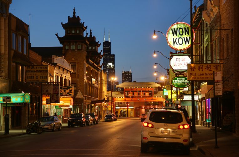
Historically, Chicagoans had a few ways of identifying where they come from. Where you went to high school is a big identifier. If a person is Catholic, then they might identify with their parish. Then people might also bring up their neighborhood.
Everyone from Rogers Park to Mount Greenwood is a Chicagoan, of course. That signifier is enough beyond our somber city. Within the city limits though, there’s a lot of space and a lot of peoples. So neighborhood identification has traditionally meant an awful lot.
Indeed, it’s not at all hard to look at census data and see just how closely neighborhood boundaries match with divisions based on class or race. The lines between the white enclaves of Mount Greenwood or Beverly stand out starkly against the African-American neighborhoods of the South Side. On the North Side, crossing the river’s North Branch clearly moves one from Lincoln Park and Lakeview, land of the bougie lakefront liberals, into the mixed and gentrifying domains of Wicker Park and Logan Square. Ours is a city built of neighborhoods, which are in turn built on an atavistic sensibility.
Chicago neighborhoods are also a thing of flux. They change with the generations – shifting with the flows of money and people. Wicker Park has been the “Polish Downtown,” a Hispanic neighborhood, and now a (mostly) white hipster haven. The boundaries have some warp and weft to them as well, especially when it comes to mini-neighborhoods. Lincoln Park, Lakeview, and Uptown all have wildly varying borders depending on whether or not you’re counting subdivisions like Buena Park or the Ranch Triangle. Sometimes neighborhoods just straight up relocate, as Chinatown once did.
Chicago Community Areas
By contrast, Chicago Community Areas are set in stone. These 77 divisions of the city were created by University of Chicago demographers back in the 1920’s. City Hall adopted them as the official community boundaries and uses them for much of the city government’s formal statistics.
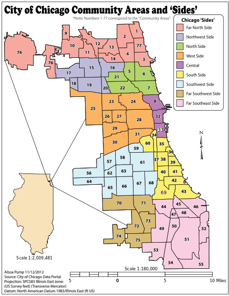
The demographers at UChicago set out on this project because they were dissatisfied with the existing division of census data. This information, such as birth and death rates, had been divvied up based on city council wards. As we’ll see, ward boundaries are very arbitrary and deeply political. So the University’s Local Community Research Committee set out to divide Chicago’s based upon its “physical barriers such as rivers, parks, and railroads…“
Now, I haven’t been able to figure out exactly why the city formally adopted these lines. Apparently the Public Health Department got in on the creation of the boundaries at UChicago. But the how/why of these lines going from Hyde Park to City Hall has eluded me. It could just be a symptom of a time when any random thought emanating from near the Midway was hailed as newly-received wisdom from on high.
City Council Wards
The city created yet another set of local jurisdictional boundaries. Just for fun and all to confuse you, my dears! The Chicago City Council has 50 seats, far less than the 77 official Chicago community areas. So the wards exist outside of neighborhood boundaries, community area borders, or basic common sense. I mean, just look at this thing.
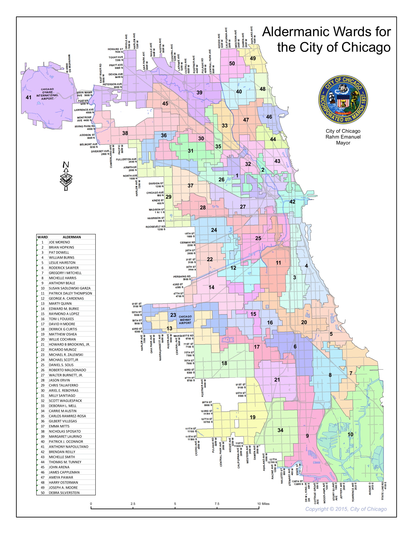
The City Council wards are the result of gerrymandering. All the boundary gymnastics of the 15th or 2nd Wards are to ensure that certain disparate population centers are grouped together. Since Chicago is a Democratic town, these are generally not partisan boundaries. At least not in the same way that the Congressional maps of Pennsylvania, Ohio, Michigan, Wisconsin, Maryland, and Illinois favor one party over another. Here in Chicago, the wards try to unite racial or ethnic communities regardless of neighborhood lines.
Invisible Walls Between Chicago Neighborhoods
The biggest distinction between neighborhoods and Chicago Community Areas is that the latter tend to be much larger. It’s not at all unusual for one community area to contain several different neighborhoods.
The Near West Side is a great example of this. The official boundaries are roughly Kinzie on the north, the river on the east, 16th Street on the South, and a railroad halfway between Western and California on the west. Within this nearly 6 square mile area one can find the following neighborhoods or sizable areas:
- West Loop
- Fulton Market
- Greektown
- Little Italy
- UIC
- Illinois Medical District
- Tri-Taylor
- Union Park
- Everything near the United Center
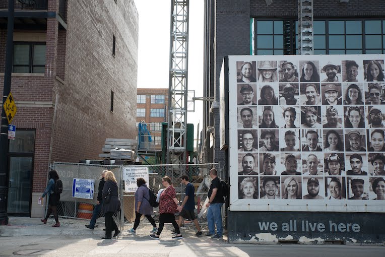
That’s so much stuff in one “community area!” One would get sociological whiplash from seeing the change in architecture and community from one end of the Near West Side to the other. It’s that sort of top-down, catch-all nature that makes Chicago community areas somewhat unwieldy and oft inaccurate.
That’s part of the reason I wanted to delve into this topic. Our systems need not be so complicated and our political boundaries don’t have to cut us off. That they do so is in service of someone or some institution(s). So knowing more than just your neighborhood is a tangible way to start peeling back the onion that is our political grid. If you want to experience the rich cultural experiences of Chicago neighborhoods, then contact us for a custom in-person or virtual tour!
– Alex Bean, Content Manager and Tour Guide
ABOUT CHICAGO DETOURS
In business since 2010, Chicago Detours is a passionate team of educators, historians and storytellers. We applied a decade of experience as one of Chicago’s top-rated tour companies to become a virtual event company in 2020. We bring curious people to explore, learn and interact about Chicago’s history, architecture and culture through custom tours, content production, and virtual events.
