As promised, we’ve done the research to answer some Chicago history questions we’ve encountered on our architectural walking tours. I’ll admit, we haven’t posted these in a while. Operating a small business is lots of work! So here we are. Thanks to all of our inquisitive guests, this will be part one of answers.
Why is the Pedway symbol blue and gold? How did they come up with that logo?
This is one of the most common Chicago history questions from our Loop Interior Architecture Walking Tour. I spoke with Vick Moore, an associate of graphic design firm Carol Naughton & Associates, who worked on the project in the early 2000s. He said the compass was basically a symbol to “imply direction,” meant to orient the Pedway walker. Many of the signs include information about street names, block numbers, and landmarks to connect people underground who may “lose touch” with the rest of the city above ground. As for the color, Moore said that many hue combinations were tested. The blue and gold was simply the most popular from an aesthetic standpoint. Apparently there’s no symbolism with the colors.
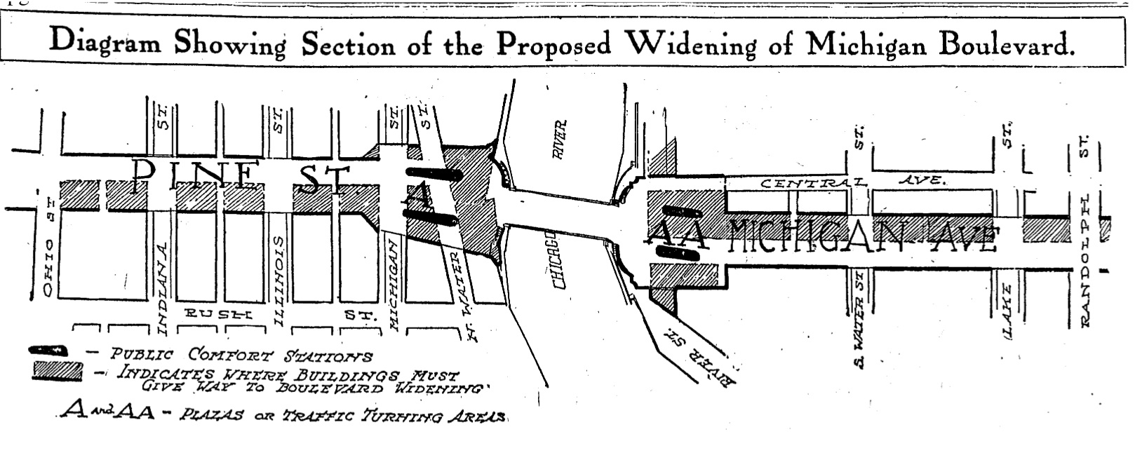 Is Lower North Michigan Avenue exactly what Pine street was?
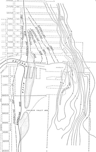
Partly. Pine Street dates back as far as 1834, back then it was a muddy trail leading north of the river to a little north of Chicago Avenue to Pearson Street – any further north and you would run into the lake’s shore. Over the years, the entire shoreline grew out farther from filling in land. The debris from the Chicago Fire of 1871 made up some landfill.
Pine Street itself changed, from ending just after Chicago Avenue. Now, it ends at Oak Street, where it becomes North Lakeshore Drive. In the 1920’s, Pine Street was also widened by 64 feet to the east. That’s when it was redubbed North Michigan Avenue. This question came up at the start of our Historic Chicago Walking Bar Tour, by the way.
Do any other cities have multiple levels like downtown Chicago and lower Wacker?
A very early concept of the double-deck street comes from 48 AD, an English town called Chester. Essentially, the foot traffic was on the bottom level and people walked above for shopping. Daniel Burnham implemented this system as part of his 1909 Plan for Chicago. No where else quite has this double-decked urban design.
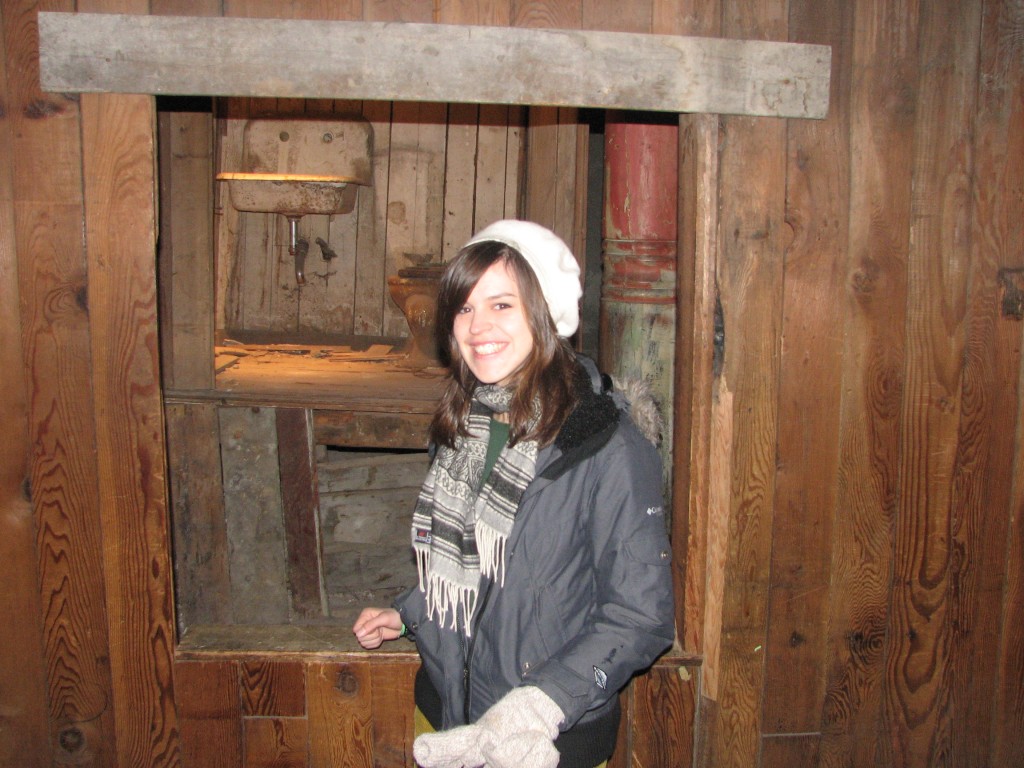
Many cities like Minneapolis, Cleveland, Montreal, even Tokyo have moderate to elaborate underground cities like our Chicago Pedway containing tunnels and malls. In the United States, Seattle‘s marshy coast had to raise their grade level to what it is now. The original street levels and underground storefronts are now part of a fun and interesting “Seattle Underground” tour (pictured here) that I was lucky enough to go on.
Another city with a lower level is Atlanta, Georgia. Its lower level was once a very popular entertainment district in the 1970’s and today is still holding on. These cities raised the street level “after the fact,” while Lower Wacker Drive and Lower Michigan Avenue were specifically designed to separate freight traffic and faster traffic from pedestrian level.
Well that’s all for now, check back later to see if any of your Chicago history questions were researched and answered here. We have more answers in the works, and if you came on our Loop Interior Architecture or Historic Chicago Walking Bar Tour walking tours and haven’t seen your question. answered, please let us know by emailing info at chicagodetours dot com.
–Marianna Foral, Research and Editorial Intern
